Days 76 – 79 – Death Valley NP, Joshua Tree NP & Slab City, California

Death Valley National Park

 Our first thoughts about Death Valley National Park were that it was going to be hot, flat and dry. When we got there two of those things were true. It was hot and dry, but it was not necessarily flat. Surrounding the valley within the park were several mountains. I guess, thus creating the valley. Death Valley National Park is home to the lowest point North America, which is pretty impressive. In the summer time temperatures can get past 120-130 degrees! It was March 20th when we arrived and it was 99 degrees. We hadn’t slept much because of our Las Vegas adventure, but it was way too hot to hang out in the tent so we decided we had to sightsee instead.

Death Valley National Park

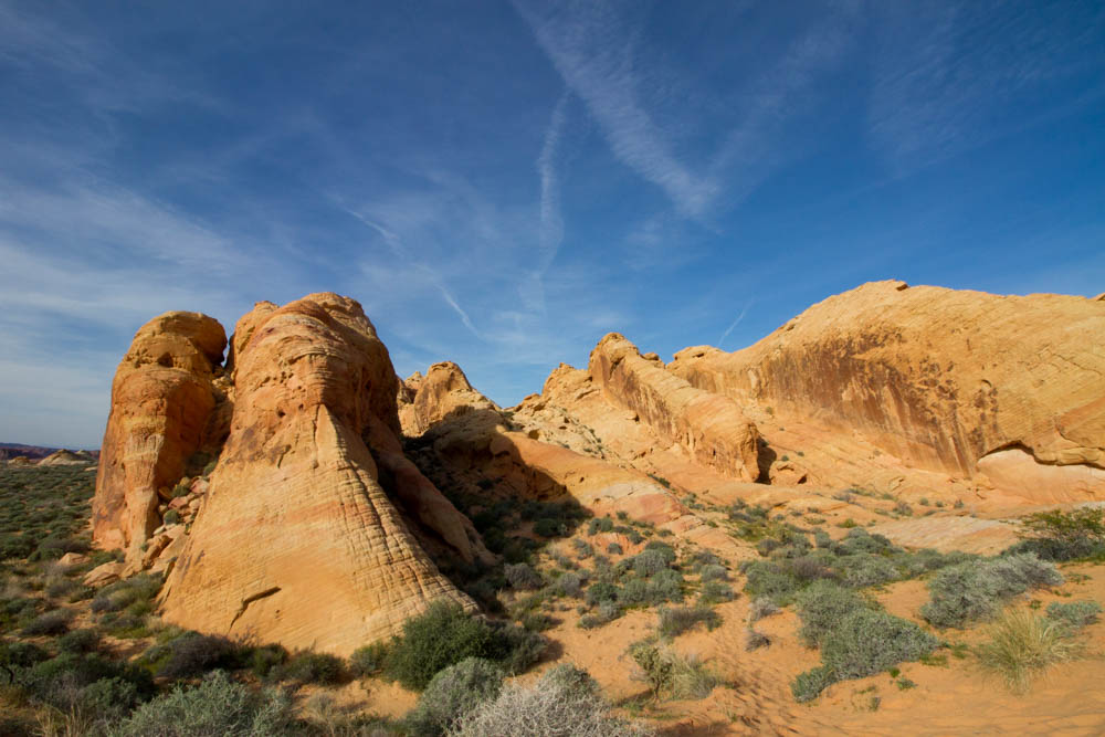
Our first stop was the Badwater Basin, this section of the park is -282 feet below sea level. There is a plaque reading “Sea Level” 282 feet over the Badwater Basin to really let you appreciate how low you’ve visited. All of the water that does end up within the basin (less than two inches a year) gets trapped then evaporates, then leaves behind mineral deposits… basically table salt, but looks like a dusting of snow. Because you’re in a valley there’s a “breeze”, however this breeze was more like 30 mph. You can taste the salt on your lips! From Badwater Basin we traveled almost an hour up to Dante’s View nearly 5,500 feet. We were surprised when we got out of the car because it was only 65 degrees! What an amazing view Dante’s View had to offer. We took several photos then made our way back down the mountain. The next morning we went on a small hike through Golden Canyon, one of the more popular hikes, semi-shaded and leads to Red Cathedral. We thought the rock formations at the end of the trail would be much more red since we had just come from some pretty red rocks.

Death Valley National Park

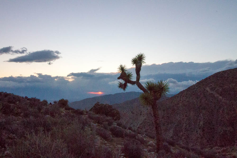
Our next stop was Joshua Tree National Park, we’ve both been craving pizza so on our way into the park we grabbed some from Pie For The People. We visited the visitor center on the west side just before entering and grabbed a map then headed to our BLM site (almost an hour and a half from the entrance), we knew camping would be full so we came prepared this time! This BLM site was literally right outside the south entrance and was blooming with flowers from the recent rain, it was mostly RV’s or campers but tents are most definitely welcome.

Joshua Tree National Park

We were only giving ourselves one day to hike through Joshua Tree, since we were camping outside of the park we picked out a few mini “hikes” and one longer hike. On the way into the park the scenery changes quite a bit, of course it’s the desert but from where we were camping it went from wild flowers to Ocotillo patches to Cholla cactuses in a few miles. Our first stop was the Cholla Cactus Garden, it was a short walk but you were able to admire the cactuses and some were  almost blooming. Our next stop was quite a bit away… We chose to hike Panorama Trail from the directory, but didn’t realize you had to leave the park to get to the trail. We had a great hike in, we saw a bunch of wildlife then when we got to the top it rained for a few minutes and it passed. 

Joshua Tree National Park

 As we hiked back down we were sort of planning what we wanted to do with the rest of the day. We were still almost 2 hours from our tent, so we planned to see the sunset. We ended up visiting Skull Rock, then stopping at Keys View for the sunset but there were just too many clouds. The next morning we left, we were on our way to Phoenix, AZ to visit Slab City. We decided not to camp there because of the reviews that we read on free campsites. However, visiting during the day seemed completely safe to visit. We were greeted by a man that gave us the whole run down of the area.

 Slab City, more or less, is an area in California that has no laws. The area used to be used for some sort of military testing, and part of it still is. Seems kind of sketchy right? It’s not as weird as it sounds once you get there, they’ve got their own system and people come and go as they please. While we were there the population was around 80, but it changes day to day. They’ve got their own hot springs, “taxi service”, library and art community. Their several art exhibits are made of things that are easy to find, anything from hay bails, wrecked cars, bullet casings, Barbie dolls, bottles and apparently plastic birds and mannequins. 

Before leaving we interacted with a few of the “locals”, one of them had only been there for 4 weeks while the other had been there for 2 years. Totally bizarre but an amazing thing to stumble upon if you’ve got the time to play with. When we left we were heading to Phoenix. The scenery on the drive over changed so much! We went from driving through a desert environment with trees & bushes, to a desert environment of just sand dunes, to a desert environment riddled with Saguaro cactuses. All we’re a truly amazing sight to see. 

Days 74 & 75 – Valley of Fire & Las Vegas

Valley of Fire

Zion treated us well, but we were on our 16th day of camping. As much as we wanted to stick around we had to keep moving, so we headed out to Nevada to visit Valley of Fire State Park, east of Las Vegas. We had planned to hike a bunch more that day and the temperature was around 80. We decided that if we could find camping inside the park we would take advantage of their showers! We made it into the park at what was apparently the right moment. Every sign leading into the campgrounds said all the sites were full but we decided to check anyways. As we pulled in the two that were working pointed us out to the last campground available and told us to hurry to the site because they’re all first-come, first-served. We set up our tent and paid our way, then went out for our hikes.

Valley of Fire

Our first hike, Fire Wave, wasn’t a long hike but it’s completely without shade so we made sure to bring along enough water. Since we missed out on The Wave in Utah at least we got to see this one, and it didn’t disappoint. The first part of the trail was in sand, but then as you get toward the end of the trail you’re walking on rock. All of the rocks had a beautiful layered pattern on them, all hues of orange as if it was on fire. Further down the road was the White Domes Loop trail, most of this trail was also sand, but the loop also takes you through a slot canyon and past a bunch of domes that are white in color at the tops. Heading back to our campsite we stopped at Rainbow Vista trail to see what it had to offer, the name lead us to believe we’d be seeing a whole spectrum of color on the rocks, however it was mostly orange and purple hues. It was a short hike, so we didn’t spend too much time before going back to camp to eat lunch.

Valley of Fire

The next morning we woke up way too early, our campsite neighbors had a bunch of kids so we couldn’t sleep even if we tried. Our original plan was to sleep as late as the sun would let us because our night was going to be spent in Las Vegas. When we got to Las Vegas we weren’t sure what to do, not only was it was daytime, but it was early! We took a drive down the main strip, then found a Total Wine so we wouldn’t spend too much money out. After contemplating for quite a bit of time about purchasing The Beatles LOVE by Cirque Du Soleil tickets we finally caved, I mean… When in Vegas?! It was expensive, but we were trying not to gamble while we were there and we’re not sure when we’ll ever be back to Vegas again. We pretty much talked ourselves into it. It was definitely worth seeing, anybody that ever finds themselves in Las Vegas should go see a show. There are several to choose from!

The Mirage Las Vegas

The show ended and we weren’t really sure what to do, so we roamed the city! It’s really quite an interesting place. I’ve been to casinos in Connecticut, and while they’re the same general idea Las Vegas casinos are a lot dirtier and smell a lot more; to be honest. We put a few dollars into a slot machine and went through it and left. The rest of our night was spent wandering around, then we left the city to head to our next destination. Apparently tent camping is illegal in the city and we didn’t have anybody to stay with so we headed toward Death Valley National Park!

Days 72 & 73 – Zion National Park

Zion National Park

In my last post, I mentioned that we were trying to gain access to The Wave in Utah through the lottery that they have. Unfortunately, we weren’t chosen for the 6-mile hike, but we had other exciting things heading our way so we weren’t too bummed out, just tired! We woke up 5:30 AM in Page, Arizona to drive up to Kanab, Utah. Most of Arizona doesn’t participate in daylights savings time while Utah still does… So, we lost an hour driving to the lottery, and we’re absolutely not morning people so we were pretty beat. We arrived to Zion National Park through the East Entrance and got amazing views heading out to the visitor center. Zion has a huge tunnel that you drive through, pretty much the side of a mountain that we were looking forward to driving through. The drive in was a great introduction to the park!

Zion National Park

Since we were so tired our first day we decided against doing a big hike, instead we got on the shuttle bus that takes you up a road you can’t drive up unless you’ve got a permit. The shuttle has a narrative that talks about each stop as you pass it, then the last stop on the trip is Riverside Walk. We got off at this stop and took the easy walk to the end and back. This walk leads to The Narrows, part of a hike that you’ve got to walk through water in a canyon to see the best parts, but Zion is pretty prone to flash floods so when the water is moving too quickly they close this portion. It was a nice walk, but we just thought it was too funny watching people in awe at the squirrels… that apparently have a habit of biting visitors, there are warning signs everywhere!

Zion National Park

Just like the Grand Canyon our luck of getting a campsite within the park was non-existent. At this point if there are no showers in the national parks I’m not sure if we’ll even try to get a spot. There’s usually Bureau of Land Management areas (BLM) right outside most parks that are completely free so we looked one up on our free campsites website and went for it. We pretty much went off-roading to get to the top of this mesa, but it was an awesome site! You wouldn’t believe the driving my little Hyundai did, I’m proud of my car! However, we decided camping on top the next night wasn’t going to be the best decision for my car so when we left the next morning we set up our tent at the bottom of the mesa so we’d have a spot for later.

Zion National Park

Hiking up Angel’s Landing trail was recommended to us so we decided to list and go up that trail. To get to it you’ve got to hike up the West Rim Trail, then hike up the Walter’s Wiggles and then you’re finally at the Angel’s Landing trailhead. The West Rim and Walter’s Wiggles are really steep, but the real challenge comes when you get to Angel’s Landing. The whole trail is lined with a chain that’s bolted to the rocks for you to hold onto, the entire trail is rock. Before you start the trail there’s a warning sign that people have died from taking the trail, and once we were up there we could see why! One wrong foot placement and something seriously tragic could happen. We made it up the trail though, 5,990 feet! We had lunch at the top and sat in what seemed like the only shade, we had an amazing view! After scuffling back down the rocks the rest of the way was easy; so easy that people were running down the steep trails.

Zion National Park

To reward ourselves after that hike, and since it was Saint Patrick’s Day, we stopped at Zion Brewing Company on the way out of the park to get some pub food. When we got back to our campsite we discovered a humongous spider hiding on the outside of our tent underneath the rainfly, Elliot took on his boyfriend duties and exterminated it for me. We admired the stars for a while then slept soundly that night.

Days 62 – 64 – El Paso & Carlsbad Caverns National Park

Carlsbad Caverns National Park

Every moment spent in Big Bend was well worth the time and effort. We weren’t quite done with Texas so before heading up to New Mexico so we stopped in El Paso to check out the area. What we didn’t realize about the area is that many of the museums are closed on Mondays, so instead we did a short hike at Franklin Mountain State Park up to a small cave. Afterwards we went for lunch at Los Bandidos de Carlos & Mickey’s and we each had a Texas-sized margarita! Even though we didn’t spend much time in El Paso it was good that we stopped, their grocery stores are super inexpensive. You can see right into Mexico from the highway, so it wasn’t surprising that their avocados and limes were under 50 cents.

Franklin Mountain State Park

On the way to Carlsbad Caverns National Park we stopped at White Sands National Monument for less than an hour just to check it out. There’s camping and hikes that you can do but we just checked out a little boardwalk and took a scenic drive. The gift shop at the monument also sells sleds so you can sled down the dunes! It was a good time watching some of the kids sled down the dunes, but it’s definitely different than sledding in the snow.

White Sands National Monument

Driving to Carlsbad Caverns was a pretty normal drive, besides the fact that we drove past areas that do missile testing for the military and there are several border patrol checkpoints. We got to our campground pretty late, but there were a few other tent campers there. It’s really amazing meeting other travelers that are doing something similar when you’re so far away from home. One was from Alaska and the other from Ohio, both escaping the winters just like we are! We exchanged stories around the fire for awhile and all contemplated this bizarre banging noise we could hear in the distance… If anybody can shed some light on the consistent banging sound that echoed through the night, please let me know!? It’s been weeks and I’m still curious about it!

Carlsbad Caverns National Park

Carlsbad Caverns National Park was the third national park we went to, but it was completely different from the others because well, it’s underground! We got there a bit later than we expected (we really aren’t morning people at all) so we couldn’t hike down into the cave, but instead we took the elevator 75 stories below the visitor center. We paid for a guided tour so we could learn more about the caverns and tour guide took us into an area that they don’t allow you to venture into by yourselves. It was well worth the money, there were several stories she knew about the park and how it got founded that we wouldn’t have learned about on our own.

Jim White, the person that found the cave, was just a curious 16-year old that saw all the  bats flying out of the cave at dusk so he investigated! He went down into the cave and found all of the stalagmites, stalactites, chandeliers and soda straws all beautifully formed. Of course, that was all seen with the help of his kerosene lantern. Without the lantern he was just sitting in darkness. Our tour guide was able to turn off the lights during part of our tour to show us just how dark the caverns really are. We were all silent while the lights were off, all you could hear was the faint dripping of water.

Carlsbad Caverns National Park

On our tour we learned that it takes hundreds and hundreds of years for these formations to get as large as they are now. They now do the tours in certain areas as a way to protect them, a lot of guests would vandalize the formations by breaking off parts to take home or even writing their names on the cave walls. Even just touching the stalagmites can damage the way they’re forming, and even stop the entire process just because of the oils from our skin. It’s too bad that visitors can’t just simply visit without damaging the cave. Of course, some parts of the cave aren’t even accessible by the average visitor. Over 120 miles of the cave have been explored and mapped out, making it the largest cave in the western hemisphere. The caverns are a really special place, I’m glad we were able to see it!

Days 57 – 61 – Big Bend National Park

Chisos Basin Hike

Connecting with friends and family that we both haven’t seen in what feels like forever has been an amazing aspect of this trip. A friend of mine from high school lives in Lubbock, TX and wanted to see us on our trip down to Big Bend National Park, it was just about the halfway point down to the park so it was a perfect opportunity to stop and see some friends! We stopped and had some dinner with them, hung out for a while then they put us up in a hotel for a night so we could cozy up before what was about to be a huge stretch on our trip. March 1st began our 21 day camping streak.

Terlingua

Our drive down to Big Bend changed drastically from the rest of the south. Gas prices rose, towns got a lot further away from one another and we saw buttes & mesas everywhere we looked! We arrived to Big Bend just before they closed their main visitor center and unfortunately all of their in-park camping was full. However, right outside the park (about 30 miles away) is a town called Terlingua, they’ve got a population of 58 but they’ve got a bunch of camping for campers that aren’t able to get a spot inside the park. We ended up camping at Topanga Ranch for the night and we didn’t regret it. It was the middle of the week, so we were the only ones in the campground… and the stars, oh my. The stars were amazing. We got up early the next morning to see the sunrise, but learned quickly that when the sun rises behind a mountain it doesn’t give quite the same effect.

Terlingua Night Sky

Another reason why we got up early that next morning was so we could get a spot to camp within the park. There are campsites that are reservable inside Big Bend but the rest of them are first come, first serve. “Check out” is noon, but if the group before you is gone before that time you can snag up their campsite. Luckily we found one right in the Chisos Basin, pretty much in the middle of the park. You don’t realize it until you get to national parks, but these parks are HUGE. Big Bend was easily 60 miles wide. It takes almost an hour just to get to where you want to go, but it’s so worth it! After we set up our tent we drove out to the Boquillas Canyon Overlook trail. It’s an easy trail that runs along the Rio Grande, so  yes… You’re right next to Mexico! We had a good time hiking this trail, we made it a bit more difficult by continuing past where the trail stopped and we had to climb a bit to get to this little patch of dirt, but we got an awesome view from the canyon.

Boquillas Canyon Overlook

Right next to the Boquillas Canyon Overlook there’s actually a border crossing within the park so you can cross over into the Rio Grande Village in Mexico, if you’ve got a passport of course. It’s a super little town that mostly survives off of the tourism from the park, but they’ve got a few restaurants and they sell little trinkets and bags. To get to the village they’ve got a little row boat that goes back and forth from America to Mexico then you’ve got the option to either walk, ride a burro (donkeys) or ride in a truck to get into town. We both rode burros and got drinks while we were there for an affordable price and I got a small gift for my dad to send back home.


Instead of camping at a normal campsite the next night we decided to backpack to a site up on the South Rim to get the most out of the park. Backpacking is no joke, especially in the heat that Texas has during the day. Not only do you have to carry enough food & water for yourself but you’ve got to be able to carry it. Elliot has backpacked before, but this was my first time. I complained the entire way up, I’m not going to lie about that. We hiked almost 10 miles up to our campsite. We carried our tent, two sleeping bags, 4 liters of water, enough food for lunch, snacks & breakfast, sunscreen, Icy Hot and CLOTHING. It gets super cold at night when you’re up high. So needless to say, our packs were pretty heavy… But it was beyond worth it, we saw so many amazing sights. We were able to catch sunset about a mile away from our campsite at an amazing lookout point. It got cold that night, it was definitely hard to sleep but we made it work!

South Rim sunset

We woke up the next morning to rain. Because why wouldn’t we? Thankfully we were able to wait it out, we had a mostly downhill hike ahead of ourselves… But it still was at least a 5 mile hike to our car. And, I forgot to mention… Our campsite that night was a little more than a mile away because we decided to backpack in again. Since we already had our site booked we stopped at the Hot Springs within the park. Elliot enjoyed the warm water, I just dipped my feet in (it really grossed me out). But it was cool to see and the whole walk down to the Hot Spring was really amazing. Not only is the wall unique just because of the rock formations, but there’s also pictographs (rock art) along the wall from thousands of years ago. That night we hiked back up to our new campsite and we pretty much passed out right away. We ate while we were off the trail so we didn’t have to worry about carrying too much food, just breakfast. And it was already dark, so we didn’t have to worry about too much water either, but our bodies were sore. Just because it was only a mile didn’t make it easy, especially because it was all uphill.

We woke up the next morning pretty refreshed, and were ready to head up toward El Paso. But before we left we stopped at what we originally thought was going to be our first stop, Santa Elena Canyon. Certain parts of the year this area of the park is closed due to flooding. There are markers on the side of the road up to 5 feet high to measure how high the water is, I don’t think anyone would want to drive their car into that! Our bodies were tired but we were happy we walked at least half of the trail. It was an amazing view down the canyon and if you yelled there was an amazing echo! I yelled and people answered me back, which has made me smile for the last month.

Santa Elena Canyon

All in all, Big Bend was so amazing to us. We really pushed ourselves to get to certain points in the park. And while, it wasn’t at all easy for me to hike the South Rim what made it easy for me was the support Elliot offered me. He knew I was having a hard time, but he knew we could both do it. We needed the space from the rest of the world for a few days, as hard of a time that we had after San Antonio we really needed some time away from big cities, and being so far away from them gives you sense of what you can do on your own. We have many other National Parks we’re going to see on this trip but I’m sure that Big Bend will remain one of my favorites.

Days 41 & 42 – Galveston, TX

Leaving New Orleans to drive into Texas was a very cool experience. We crossed the Louisiana Texas border into very poorly paved roads, but ended up stopping at an incredibly inexpensive grocery store. It was just your usual Kroger, but traveling through so many state lines you do notice a difference in prices in certain things. After the grocery store we went to our free campsite for the night. 


The site we had picked out was literally right on the Gulf of Mexico on what used to be Highway 87 in Bolivar Point. This road was completely destroyed in 2008 by Hurricane Ike. What’s left is now a dirt road, chunks of the asphalt of what used to be the road and a bunch of oil rigs. Setting up the tent wasn’t easy by any means, it was super windy but it got done. After we were done setting up we decided to make our macaroni & (dairy free!) cheese with pork & beans Valentine’s Day dinner. It was so windy we just went with what was going to be easiest. The stars that were out that night were no joke! It was absolutely amazing to look up, but then some clouds rolled in and we got in our tent that was whipping all over the place from the wind. We had to get back out and tie the guy lines down to stop the tent from blowing over, or worse.. one of our tent poles breaking!


The next day we went into Galveston to explore. Our first stop was to Moody Mansion, an estate that was owned by William Moody, a clearly successful business man. The tour through the house is audio guided and tells stories about the family and gives you information about his business moves. The house has 31 rooms, most of its original furniture and is part of the National Register of Historic Places. The mansion stood through several hurricanes like the Great Galveston Hurricane of 1900 and Hurricane Ike. We learned a lot about how they built a 14 foot wall to lift Galveston up to protect them from future hurricanes better. 


After a quick lunch in the parking lot we ventured down to The Strand to check out their downtown area. Apparently Galveston has a whole Mardi Gras celebration too! We had no idea, but they had everything set up for the festivities and the parade route. We dipped into La King’s Confectionery where they were pulling their own salt water taffy! Apparently much like anywhere else that celebrates Mardi Gras they also don’t have laws in this specific district about drinking on the streets, and they had amazing 2 for $5 deals on beer and wine, so we grabbed a drink and made plans to visit the beach area. 


There are a few beaches in Galveston but there’s one area that has a pier with an amusement park on it and a whole slew of restaurants. We thought we’d be able to walk the pier, but the amusement park was closed so we just walked along the beach for a bit before heading to East Beach for the sunset. 


That night we drove up to Houston to meet up with a bunch of Elliot’s family that were letting us stay in their home for the next few days. We went to Pico’s Restaurant for dinner and margaritas. Pico’s was a bit different than the typical Mexican food in the Houston area because they focus on more authentic flavors from the seven regions of Mexico. I had the pork shank that was recommended by the waiter and Elliot had Mancha Mantales, a chicken & pork dish with a peanut sauce and mole served with plantains, sweet potatoes, fruit and of course rice & beans. It was nothing short of amazing, what a great way to end our day!

Days 36 & 37 -Pensacola, FL & Mobile, AL

Sunset at Fort Pickens in Pensacola

After we decided to end our trip down the Natchez Trace Parkway we camped in Mississippi, the next day we started our trek out to Pensacola, Florida. As I mentioned in the last blog post, we changed up our route a little bit so we could see some of the upcoming Mardi Gras parades in Mobile, AL and New Orleans, LA.

We camped at Fort Pickens in Pensacola. Fort Pickens used to be a military fort on Santa Rosa Island. The campground is located on an island between the Pensacola Bay and the Gulf of Mexico. To get onto the island you have to pay a $15 fee because it’s protected by the National Park Service, but with an annual National Parks pass you can get onto the island for free. Camping was pretty inexpensive, there were restrooms (showers!) and direct access to both beaches. Since we were only staying for one night, seeing a sunset was a must.


After we enjoyed the sunset on the Gulf we walked over to the opposite side of the island to see the Pensacola Bay at night. It was still a very nice beach, but it was so much brighter and windier. We stuck it out for a bit but ended up walking back over to the gulf side so we could cuddle under the stars. It was really cool because naval helicopters kept flying overhead throughout the night so we had something watch. While it wasn’t the warmest night, it was a lot warmer than back home that was being pummeled with 12 inches of snow…  So we enjoyed it!

The next morning we packed up and headed towards Mobile, Alabama. We decided to take the scenic route and take a ferry across the Pensacola Bay, it was an it longer, but it was worth it. We got to drive down Santa Rosa Island and see some different things then see the water where we saw lots and lots of birds. By the time we made it to Mobile it was getting pretty close to parade time so we found a parking lot and got ready to watch the parade. And by getting ready we mean, making drinks and stuffing some food in our faces. It’s legal to carry your own drinks around within the entertainment district in Mobile, so we took advantage!

Mobile's Mardi Gras Parade
The parade was a great time! Everybody knows New Orleans for their parades, but very few people realize that Mobile is where Mardi Gras first got started! The parade we saw was called “Conde Cavaliers”. It had several floats, high school bands from the area and of course some awesome throws. Some of the throws included moon pies (Mobile is where they come from!), stuffed animals, footballs, Ramen and of course… BEADS!


After the parade everybody flocked to Dauphin Street for the bars and the food stands, because we knew we’d be stuck in the parking lot due to the immediate steet clean up and the traffic we decided to check out their night scene too. We didn’t drink at the bars because we had a bit of a drive, but the people watching was awesome. It looked like a pretty neat area to hang out in. That night we camped in Mississippi again at the same spot we did before Pensacola because it was free, it was safe and it wasn’t far from New Orleans for our trip the next morning. 

Days 34 & 35 – Nashville, TN and The Natchez Trace Parkway

The Parthenon in Nashville

Our last morning in Tennessee we spent our time (sitting in mass amounts of traffic) to visit The Parthenon. Right smack in the center of Centennial Park stands a full-scale replica of The Parthenon in Athens, Greece. After the park we started our drive down The Natchez Trace Parkway.

The Parthenon in Nashville

Inside the The Parthenon is a 42-foot statue of Athena, as well as an art museum. There is an entrance fee to see the inside, but if you’re making your way out to see the outside, you might as well see the inside for $6 ($1 off with a student ID), and it really is truly unbelievable. The Athena statue is obviously just a recreation, but it stood for 12 years as just a plain white statue, but in 2002 they gilded the statue with real gold and painted in additional details. Our jaws dropped when we entered the second floor.

When we left the park we started our journey down The Trace. The parkway is protected by the National Park Service, so you can only imagine some of the sights there are to see. It’s a 444-mile drive that follows the original route that Lewis and Clark followed on their expedition; it runs from Nashville, through a corner of Alabama and through most of Mississippi. Not only is it a scenic drive, but there’s also a ton of hiking,biking, camping and horseback riding. We made a few stops at some scenic outlooks and took a short hike to a waterfall our first night then camped in Muscle Shoals, Alabama for $10 for the night.

Jackson Falls on the Trace

The next morning we got back on The Trace and checked out a bunch of different sights. At the beginning of the parkway they supply maps so you can get the most out of your drive. We traveled more than 300 miles down the parkway, but we didn’t make it all the way down. We had other plans for the next few days and with it getting dark we took the night to camp for free at the De Soto National Forest in Mississippi. Not many free camping sites have running water, but this one did. No shower, but toilets are always nice… especially when there’s a bunch of other people camping in the same vicinity as you. It was an awesome site right next to a lake, you just kind of pick a spot and pop your tent up.

One thing that concerned us about this site was this cat that kept circling the forest, which wouldn’t have been a big deal but we couldn’t see the cat and it sounded big! After we got settled into the tent we heard it right outside. It sounded like it was trying to get into another camper’s food or into our car. We tried to see it with a flashlight, but we had no luck! Finally we got some sleep, but it was definitely nerve racking thinking a big cat was trying to get into your car! The next morning we headed back east a bit to go to Pensacola, Florida in the panhandle. The original plan was to go to Mobile, Alabama, then to Pensacola, then back west over to New Orleans, but with Mardi Gras coming up we decided to shuffle the dates around a bit so we could check out some parades!

Day 18, 19 & 20 – Severe Weather & Orlando

Ocala National Forest

While we were in Savannah there was some severe weather, but there was much more forecasted for the rest of the night. When we left Savannah we had a free campsite in mind that had running water. We weren’t sure what it would hold in store for us though since the last free site that we looked for was full, but the weather wasn’t holding up well so we decided to go for it. We stayed at the Clayhole Swamp in Brunswick, Georgia. It was easy to find the park, but finding the camping area wasn’t easy.

To find the site we had to drive about a mile to get to an information kiosk that was supposed to tell us where the camping was. We also found out at that kiosk that there was hunting in the park, so we did not want to camp in the wrong spot… And while we had a map, the map had street names and everything, but nothing on the road was marked. And it was dark, everything was extremely inaccurate. But we did eventually find our way! When we pulled in there was one other truck there, they had a tent set up and all their lights were out. They were the only other people there, and somehow this made us really nervous. Then of course, it started to rain. We set up our tent and we were drenched.

By the time we were done setting up our tent it had started thundering and lightning a bunch more, there was barely any service. We visited the bathrooms to check it out, and we made the executive decisions not to use them unless we absolutely had to. At that point we decided against cooking with the grill and made some bagels. We listened to some music trying to get over that feeling of anxiousness and finally fell asleep. We woke up to thunder and lightning again the next morning. When I got up our neighbors were also awake, so I decided it was best to use the bathroom rather than out in the rain. While I was in there the rain came down really heavy. I had to run back to the tent. We sat in there for about a half hour before we decided that it wasn’t going to stop raining and just to pack up the inside and when the rain slowed we would tear the tent down and pack everything into the car. I didn’t end up taking any photos at this site because of how much it was raining.

On our way out of Brunswick we stopped at a Dunkin’ Donuts to try and use their wifi to update the blog, it didn’t work out. Then we made our way down to Barnes & Noble in Jacksonville, FL and their wifi wasn’t working well enough to upload any photos. So we decided to go straight to our next free campsite in the Ocala National Forest.

Our way down it was raining on and off so we figured the site wouldn’t be too packed… plus there was the whole tornado watch thing but when we parked our car there were two other cars there, but everybody was swimming. They seemed like they were locals and they got out of there relatively fast. We got our camp set up (second time in the daylight!), made dinner and it started raining. We had pretty good timing with this one.

It rained for a while that night, we played Connect Four and colored in my coloring books for quite a bit. We had basically no service and it got dark super early since the storm rolled in so quickly so we had to make due with what we had, but we had fun! Besides the storm we thought the campsite was awesome, there was a swimming hole, and there were only three individual sites, so if anybody else had joined us we wouldn’t be able to see them because they were separated. There were no bathrooms or electricity, but it didn’t matter. I’d almost rather no bathrooms than the bathrooms that we had at the swamp that I didn’t want to use.

On our way in the day before we had to pass a tree that had fallen down, there was just enough room to pass it on one side, I had to get out and hold some of the branches back so it wouldn’t scratch my car but it worked out. While there really weren’t any high winds during the storm that night we weren’t sure if anything had fallen so our fingers were crossed that we’d be able to get out! We got to the same tree that was down the day before and there was a second one down. Thankfully there was enough more than enough room to get through to the exit and everything worked out, but we sure were nervous when we saw it at first.

Ocala National Park

After we exited the park, we were off to Orlando to visit Universal Studios! Neither of us had ever been but we were really excited. We had a great day riding tons of roller coasters and experiencing the magic of Harry Potter. The 3-D rides were our favorite, I don’t think I’ve ever been on anything like these rides. While it was pretty expensive to get into the park we had a great day so I don’t think we regretted spending the money. Hogsmeade and Diagon Alley were enough to make it worth it for me, I think.

After Universal Studios closed we headed to West Palm Beach where Elliot’s grandpa is staying right now, so we had a bed to sleep in and a shower to use! I don’t think either of us have been more excited to use either. I fell asleep pretty much as I hit the pillow. It was a great day, but very exhausting!

Day 16 & 17 – Savannah, GA

As many of our friends and family may know, we have a general route that we’ve planned for our entire road trip… but we’re still pretty much winging it. We’ve planned a bunch of specific places that we want to see, things we want to do and things we want to eat. But not so much where we want to sleep every night. Of course, a lot of places we’re getting a lot of help from our family and friends (thanks again guys!) but where we don’t know anybody we’re kind of planning as we go. The Savannah area was one of those.

On the drive down from Charleston we stopped at Hyundai to get my windshield wipers looked at, because as I mentioned in this post they were messed up and it was supposed to rain the next few days. Hyundai was all booked up, but they told us to hang out before we left and they’d check it out before they closed. While we waited for an available slot we checked out Folly Beach on James Island in Charleston. During the winter months dogs are allowed on the beach, so I of course had an amazing time. We went back to the dealership and everything worked out so we went on our way to Savannah. We didn’t really know where we were headed though… There weren’t any free campgrounds that were close to the city so we put Tybee Island into the GPS. When we got there we booked a campsite at River’s End Campground.

Tybee Island Beach

River’s End Campground was a great campsite! A little weird, it was located right next to the police station. And the back end of the campsite was the entrance to an impound lot? But it was amazing, we checked into our site a few minutes before the office closed (meaning we set up our tent in the daylight for the first time this trip). While I was checking in I saw that they had a movie night at 7:30, and they were showing Finding Dory! Of course we went. When we walked back to our campsite two more campers were setting up one site away from us. They said hello to us and finished setting up, Elliot built a fire and I attempted to write a blog post (which obviously failed). They offered us some food and they came and hung out at our fire. They were some really great people and we exchanged numbers, we may hang out when we reach Washington.

River's End Campground

We were unsure about our day going into Savannah, since we’re camping so much we check the weather as often as we can just to see what we’re getting ourselves into. There were supposed to be “severe thunder storms” and a “tornado watch” for most of the early evening. We had already made a reservation for 5:45 for the Haunted Hearse Tour in Savannah, but everything else was up in the air. We were only about a block or two away from the Tybee Island Light House so we decided to go there first.

Once we got to the lighthouse you could really tell that some type of weather was coming in. It wasn’t even really foggy.. It was cloudy, but ridiculously low. We tried to take photos, but it doesn’t show it quite the way that we saw it. Regardless, we walked to the top of the lighthouse before they closed it due to the weather. It was steep on the way up (and the way down), and it was super windy when we got to the top. It was worth the climb, but we couldn’t see as far as we wanted to because of the clouds. There were a bunch of other buildings to check out on the grounds, it was all original furniture from the family that lived there in the 1800’s. It was interesting to see what furniture from that time frame looked like.

When we left the lighthouse we went to the Oatland Island Wildlife Center of Savannah. They have many different animals in their exhibits for many different reasons, but they just opened a wolf exhibit and they were very happy running around when we first got there. We spent a lot of time watching them and then they settled down. They also have bison, cougars, alligators, foxes, bobcats, eagles, vultures and many different owl species & barn animals.

Toward the end of the trail we heard thunder starting to roll in. We weren’t exactly worried, but we knew that it could get serious so we made sure to finish quickly. While we were walking back to the visitor building we got picked up by an employee on a golf cart, apparently they were closing early and we were the only visitors left. As soon as we got on the cart it started down pouring, we had to leave the park since they were closed but it wasn’t easy to see at all. We ended up driving to a nearby Walmart to pass the time, and we had to grab a few things anyways.

After the rain passed we went into the city to meet up with our Haunted Hearse Tour. It was still raining a bit, but not too much to cancel the tour. It was us and a family of 5 on the tour, so it was pretty personal for the entire ride. We had Peg Leg Ron as our tour guide, and while we bit our tongues in some situations most of the tour was really funny. Apparently Savannah has a lot of ghost stories to tell, a lot of them hilarious because of the ironic placement of present day popular places to visit and photograph. At the end of the tour he dropped the family off to where they wanted to eat for dinner and he dropped us off at Leopold’s Ice Cream. I actually lost my camera lens cap too, and he called me back to meet up with me so I could get it back which was very nice of him, since I had already written it off as “gone forever”.

Haunted Hearse Tour in Savannah

Savannah was a great city to visit, after the hearse tour we explored River Street, but I had been told that it’s a pretty touristy area before I went, and they weren’t wrong. It lived up to that standard, but I did find a sticker that I wanted to buy. That night, yet again, we weren’t sure of where we were camping… But it was still severe weather and the tornado watch was still in effect so I’m going to leave that story for the next blog post because it was pretty interesting to say in the least…